Showing posts with label Places. Show all posts

Friday, March 1, 2013

Centralia, Pennsylvania


Centralia is a borough and ghost town in Columbia County, Pennsylvania, United States. Its population has dwindled from over 1,000 residents in 1981 to 12 in 2005, as a result of a mine fire burning beneath the borough since 1962. Centralia is one of the least-populated municipalities in Pennsylvania.
Centralia is part of the Bloomsburg-Berwick micropolitan area. The borough is completely surrounded by Conyngham Township.
All properties in the borough were claimed under eminent domain by the Commonwealth of Pennsylvania in 1992 (and all buildings therein were condemned), and Centralia's ZIP code was revoked by the Postal Service in 2002. A few residents continue to reside there in spite of the failure of a lawsuit to reverse the eminent domain claim.

Wednesday, August 22, 2012

Wadi

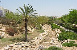
Wadi is the Arabic term traditionally referring to a valley. In some cases, it may refer to a dry (ephemeral) riverbed that contains water only during times of heavy rain or simply an intermittent stream.

Modern English usage differentiates a wadi from another canyon or wash by the action and prevalence of water. Wadis, as drainage courses, are formed by water, but are distinguished from river valleys or gullies in that surface water is intermittent or ephemeral. Wadis, cut by stream in a desert environment, generally are dry year round except after a rain. The desert environment is characterized by a sudden but infrequent heavy rainfall often resulting in flash floods. Crossing wadis at certain times of the year can be dangerous because of unexpected flash floods. Such flash floods cause several deaths each year in North America and many Middle Eastern countries.

Wadis tend to be associated with centers of human population because sub-surface water is sometimes available in them. Nomadic and pastoral desert peoples will rely on seasonal vegetation found in wadis, even in regions as dry as the Sahara, as they travel in complex transhumance routes.

Sunday, February 12, 2012

Mount Parnassus

Mount Parnassus is a mountain of limestone in central Greece that towers above Delphi, north of the Gulf of Corinth, and offers scenic views of the surrounding olive groves and countryside. According to Greek mythology, this mountain was sacred to Apollo and the Corycian nymphs, and the home of the Muses.

Mount Parnassus is named after Parnassos, the son of the nymph Kleodora and the man Kleopompus. A city, of which Parnassos was leader, was flooded by torrential rains. The citizens ran from the flood, following wolves' howling, up the mountain slope. There the survivors built another city, and called it Lykoreia, which in Greek means "the howling of the wolves."

While Orpheus was living with his mother and his eight beautiful aunts on Parnassus, he met Apollo who was courting the laughing muse Thalia. Apollo became fond of Orpheus and gave him a little golden lyre, and taught him to play it. Orpheus's mother taught him to make verses for singing.

As the Oracle of Delphi was sacred to the god Apollo, so did the mountain itself become associated with Apollo. According to some traditions, Parnassus was the site of the fountain Castalia and the home of the Muses; according to other traditions, that honor fell to Mount Helicon, another mountain in the same range. As the home of the Muses, Parnassus became known as the home of poetry, music, and learning.

Parnassus was also the site of several unrelated minor events in Greek mythology.

  • In some versions of the Greek flood myth, the ark of Deucalion comes to rest on the slopes of Parnassus. This is the version of the myth recounted in Ovid's Metamorphoses.
  • Orestes spent his time in hiding on Mount Parnassus.
  • Parnassus was sacred to the god Dionysus.
  • The Corycian Cave, located on the slopes of Parnassus, was sacred to Pan and to the Muses.

Parnassus was also the home of Pegasus, the winged horse of Bellerophon.

Today, the slopes of Mount Parnassus are the location of two ski centres. The Parnassos Ski Centre is composed of two sections, Kellaria and Fterolakka, which together make up the largest ski center in Greece. A smaller ski centre (only two drag lifts) called Gerontovrahos is across a ridge from Kellaria. Parnassus is mined for its abundant supply of bauxite which is converted to aluminium oxide and then to aluminium.

Saturday, January 21, 2012

Binondo

Binondo is an enclave in Manila primarily populated by ethnic Chinese living in the Philippines. It is the oldest Chinatown in the world, established in 1594. Historically, Binondo was the area where the Spanish permitted converted sangleys, their indigenous Filipino wives, and their mixed-race descendants, the mestizos de sangley or Chinese mestizos, to reside. Similarly, Parían, an area near Intramuros, was where the Spanish first restricted unconverted Chinese immigrants to live. They allowed sangley settlement at Parían because it was within the range of Intramuros cannons, and they felt they could control any uprising from the laborers.

Located across the Pasig River from Intramuros, Binondo has typified a small Chinese town. Locally it has been called "China Town". The district is the center of commerce and trade for all types of businesses run by ethnic Chinese merchants. Given the historic reach of Chinese trading in the Pacific, this district was already a hub of Chinese commerce before the first Spanish colonists came in 1521.

Wednesday, January 11, 2012

Jamkaran

Jamkaran, Iran (on the outskirts of Qom) is the site of the Jamkaran Mosque, a popular pilgrimage site for Shi'ite Muslims. Local belief has it that the Twelfth Imam (Muhammad al-Mahdi) — a messiah figure Shia believe will lead the world to an era of universal peace — once appeared and offered prayers at Jamkaran. On Tuesday evenings especially large crowds of tens of thousands gather at Jamkaran to pray and to drop a note to the Imam in a well at the site, asking for help with some problem.

The mosque, six kilometres east of Qom, has long been a sacred place, at least since 373 A.H., 17th of Ramadan (22 February 984 C.E.), when according to the mosque website, one Sheikh Hassan ibn Muthlih Jamkarani is reported to have met Muhammad al-Mahdi along with the prophet Al-Khidr. Jamkarani was instructed that the land they were on was "noble" and that the owner — Hasan bin Muslim — was to cease cultivating it and finance the building of a mosque on it from the earnings he had accumulated from farming the land.

In the late 20th century, the mosque's reputation spread, and many pilgrims, particularly young people, began to come to it. In the rear of the mosque there is a "well of requests" where it is believed the Twelfth Imam once "became miraculously unhidden for a brief shining moment of loving communion with his Creator." Pilgrims tie small strings in a knot around the grids covering the holy well, which they hope will be received by the Imam Mahdi. Every morning custodians cut off the strings from the previous day.

Sunday, December 11, 2011

Luna Park

Luna Park is a name shared by dozens of currently operating and defunct amusement parks that have opened on almost every continent except Antarctica since 1903. The first to use the name was the second major amusement park at Coney Island, designed by Charles I.D. Looff, who subsequently designed Seattle, Washington's Luna Park, which opened in 1907. The spaceship in the Pan-American Exposition ride "A Trip to the Moon" gave its name to these parks... and to dozens that followed over the next century.

In 1905, Frederick Ingersoll was already making a reputation for his pioneering work in roller coaster construction and design (he also designed scenic railroad rides) when he opened Luna Parks in Pittsburgh and Cleveland, the first two amusement parks to be covered with electric lighting (the former was adorned with 67,000 light bulbs; the Cleveland park had 50,000). Ultimately he opened 44 Luna Parks around the world, the first chain of amusement parks.

Despite the death of Ingersoll in 1927 and the closing of most of his Luna Parks, the name's popularity continued with newer parks with the name opening with regularity. As a result, "Lunapark" now translates into "amusement park" in Bulgarian, Croatian, Dutch, German, Greek, Hebrew, Italian, Macedonian, Polish, Russian, and Turkish.

Thursday, November 17, 2011

Boring, Oregon

Boring is an unincorporated community located in Clackamas County, Oregon, United States, on Oregon Route 212. It is approximately eight miles south of Gresham and about the same distance from Clackamas, both suburbs of Portland. The town is roughly twenty-two miles southeast from downtown Portland.

The community was named after William H. Boring, an early resident of the area. Boring was a Union veteran who had moved out to Oregon after the Civil War. He had served with the 33rd Illinois Infantry, Company D, after enlisting on August 16, 1861 and was mustered out on February 1, 1865 due to disability. Boring died in 1932 at the age of 91 and was buried with his wife Sarah in Damascus Pioneer Cemetery.

Boring was platted in 1903 as "Boring Junction". The post office was established and named "Boring" the same year, and the builders of the interurban railway adopted Boring as the name of the community.


In 2005, citizens of Boring applied to become one of the first legally recognized villages in Oregon. However, after many months of polarizing debate on the village issue, residents narrowly defeated the village designation in a town hall referendum in August 2006, with 293 votes in favor and 298 against.


The unique name of the town often prompts its inclusion on lists of unusual place names. The name "Boring" is embraced by locals, however, and found in many local businesses, resulting in many road signs that seem humorous to outsiders. Boosters of the village designation use the slogan "The most exciting place to live."

Tuesday, October 18, 2011

Bauhaus

Staatliches Bauhaus, commonly known simply as Bauhaus, was a school in Germany that combined crafts and the fine arts, and was famous for the approach to design that it publicized and taught. It operated from 1919 to 1933. At that time the German term Bauhaus, literally "house of construction" stood for "School of Building".

The Bauhaus school was founded by Walter Gropius in Weimar. In spite of its name, and the fact that its founder was an architect, the Bauhaus did not have an architecture department during the first years of its existence. Nonetheless it was founded with the idea of creating a 'total' work of art in which all arts, including architecture would eventually be brought together. The Bauhaus style became one of the most influential currents in Modernist architecture and modern design. The Bauhaus had a profound influence upon subsequent developments in art, architecture, graphic design, interior design, industrial design, and typography.

The school existed in three German cities (Weimar from 1919 to 1925, Dessau from 1925 to 1932 and Berlin from 1932 to 1933), under three different architect-directors: Walter Gropius from 1919 to 1928, Hannes Meyer from 1928 to 1930 and Ludwig Mies van der Rohe from 1930 until 1933, when the school was closed by its own leadership under pressure from the Nazi regime.

The changes of venue and leadership resulted in a constant shifting of focus, technique, instructors, and politics. For instance: the pottery shop was discontinued when the school moved from Weimar to Dessau, even though it had been an important revenue source; when Mies van der Rohe took over the school in 1930, he transformed it into a private school, and would not allow any supporters of Hannes Meyer to attend it.

Monday, July 25, 2011

Mount Kythnos

Mount Kythnos is the highest point of the Greek holy island of Delos, part of the Cyclades.

Greek mythology states that Zeus observed the birth of his son Apollo (with Leto) from this vantage point. As the centre of the circular Aegaean islands ("Cyclades"), Mount Kythnos offers superb views of the innermost islands: Mykonos, Naxos, Paros, Syros, and Rhenia.

Monday, July 11, 2011

Werribee Park

Werribee Park is the estate of a historical building in Werribee, Victoria, Australia. It includes Werribee Park Mansion, the Victorian State Rose Garden, formal gardens, the Werribee Park National Equestrian Centre, the Werribee Open Range Zoo, a contemporary sculpture walk and a natural riverine which is being grown with the plants of the Kurung Jang Balluk clan who lived on Werribee River. There is also the Mansion Hotel and Conference Centre. The Park was purchased by the Victoria State Government in 1973. It was opened as a tourist attraction in 1977. It is run by Parks Victoria.
Werribee Park Mansion was built by pastoralists Andrew Chirnside and Thomas Chirnside between 1874 and 1877 in the Italianate style. Its residential and working buildings supported a large farm workforce. The rooms open to the public include the billiardroom, the main bedrooms, the reception rooms and part of the kitchen. When Thomas Chirnside committed suicide, some of the property was passed on to George Chirnside, thus building the Manor in the 1890s. From 1923 to 1973, the Mansion was a Catholic seminary, Corpus Christi College. The wings which are now the Mansion Hotel were added during that period. In 1996, episodes, set in England, of The Genie From Down Under TV series were shot at the mansion. Also most rooms in the house were used for an American based movie called, "The Pirate Movie" starring Kristy McNichol and The Blue Lagoon's Christopher Atkins.
In December 2007, the Werribee Park Mansion hosted an Elton John concert as part of his Rocket Man Solo Tour.
Once a year the Werribee Mansion Grounds are used to hold the Werribee Christmas carols.

Friday, June 10, 2011

Idiotville, Oregon

Idiotville is a ghost town and former community located in Tillamook County, Oregon, United States, near the mouth of Idiot Creek on the Wilson River, on the route of Oregon Route 6.Idiotville's elevation is 1200 feet.
It is in the Tillamook State Forest, along the Tillamook-Washington county line, approximately 50 miles west northwest of Portland. Nothing remains at the site.
The nearby stream was named Idiot Creek after the community and was added to the official United States Board on Geographic Names list in 1977. About a half mile up Idiot Creek was a logging camp called Ryan's Camp, which was part of the salvage operations following the Tillamook Burn. Since the spot was so remote, it was said that only an idiot would work there, so the camp was popularly known as Idiotville. The name was eventually applied to the stream.

Tuesday, May 24, 2011

Terra Incognita

Terra incognita (Latin "unknown land," with incognita stressed on its second syllable in Latin, but with variation in pronunciation in English) is a term used in cartography for regions that have not been mapped or documented. The expression is not found in ancient texts, and occurs first in the sixteenth century. The equivalent on French maps would be terres inconnues (plural form), and some English maps may show Parts Unknown.
Similarly, uncharted or unknown seas would be labeled mare incognitum, Latin for "unknown sea".
An urban legend claims that cartographers labelled such regions with "Here be dragons". Although cartographers did claim that fantastic beasts (including large serpents) existed in remote corners of the world and depicted such as decoration on their maps, only one known surviving map, the Lenox Globe, in the collection of the New York Public Library, actually says "Here be dragons" (using the Latin form "HIC SVNT DRACONES"). However, ancient Roman and Medieval cartographers did use the phrase HIC SVNT LEONES (literally, Here are lions) when denoting unknown territories on maps.
Alternatively, terra incognita may also refer to the imaginary continent Terra Australis.
During the 19th century terra incognita disappeared from maps, since both the coastlines and the inner parts of the continents had been fully explored.
The phrase is now also used metaphorically by various researchers to describe any unexplored subject or field of research.

Sunday, March 6, 2011

Bubbly Creek

Bubbly Creek is the nickname given to the South Fork of the Chicago River's South Branch, which runs entirely within the city of Chicago, Illinois. Gases bubbling out of the riverbed from the decomposition of blood and entrails dumped into the river by the local stockyards in the early 20th century give the creek its name. It was brought to notoriety by Upton Sinclair in his exposé on the American meat packing industry entitled The Jungle.

The area surrounding Bubbly Creek was originally a wetland; during the 19th century, channels were dredged to increase the rate of flow into the Chicago River and dry out the area to increase the amount of habitable land in the fast-growing city. The South Fork became an open sewer for the local stockyards, especially the Union Stock Yards. Meatpackers dumped waste, such as blood and entrails, into the nearest river.[2] The creek received so much blood and offal that it began to bubble methane and hydrogen sulfide gas from the products of decomposition.

In 1906, author Upton Sinclair wrote The Jungle, an unflattering portrait of America's meat packing industry. In it, he reported on the state of Bubbly Creek, writing that:


"'Bubbly Creek' is an arm of the Chicago River, and forms the southern boundary of the Union Stock Yards; all the drainage of the square mile of packing-houses empties into it, so that it is really a great open sewer a hundred or two feet wide. One long arm of it is blind, and the filth stays there forever and a day. The grease and chemicals that are poured into it undergo all sorts of strange transformations, which are the cause of its name; it is constantly in motion, as if huge fish were feeding in it, or great leviathans disporting themselves in its depths. Bubbles of carbonic gas will rise to the surface and burst, and make rings two or three feet wide. Here and there the grease and filth have caked solid, and the creek looks like a bed of lava; chickens walk about on it, feeding, and many times an unwary stranger has started to stroll across, and vanished temporarily. The packers used to leave the creek that way, till every now and then the surface would catch on fire and burn furiously, and the fire department would have to come and put it out. Once, however, an ingenious stranger came and started to gather this filth in scows, to make lard out of; then the packers took the cue, and got out an injunction to stop him, and afterwards gathered it themselves. The banks of 'Bubbly Creek' are plastered thick with hairs, and this also the packers gather and clean."

Two heavily polluted streams that joined to create the south fork were later filled in, but their courses can still be seen today in the configuration of streets and railroad tracks in the area.

The creek has remained toxic to the present day; a resident in the 1950s and '60s remembers the air being "rancid". While the area has been increasingly occupied by residential development such as Bridgeport Village, some wildlife and vegetation has returned in recent decades. Alligators have been found living in the creek, some weighing up to 45 pounds. Areas near the creek have been designated for recreational uses including parks, and developers and the city agreed on a 60-foot (18 m) setback to allow for remediation. During heavy rains, millions of gallons of wastewater are dumped into the stagnant creek by the Metropolitan Water Reclamation District of Greater Chicago.

A program to oxygenate the creek by continuously injecting compressed air into the water has met with limited success: The creek's odor is much reduced, and fish now venture there.

As of 2007, the City of Chicago and the Army Corps of Engineers are considering a $2.65 million feasibility study to look at restoration options, which would have implications for the remainder of the Chicago River system due to the unusual challenges of Bubbly Creek. The creek's waters are largely stagnant, having little gravitational flow, but the study will look into possibilities including a meandering stream amid a wetland to restore an oxygenated system.

Tuesday, February 22, 2011

Devil's Island

Devil's Island is the smallest and northernmost island of the three Îles du Salut located about 6 nautical miles (6.9 mi) off the coast of French Guiana . It has an area of 34.6 acres. It was a small part of the notorious French penal colony in French Guiana until 1952.

The rocky, palm-covered island rises 40 m (130 ft) above sea level. The penitentiary was first opened by Emperor Napoleon III's government in 1852, and became one of the most infamous prisons in history. In addition to the prisons on all three islands, prison facilities were located on the mainland at Kourou. Over time, they became known collectively as "Devil's Island" in the English-speaking world, while they are known in France as the bagne de Cayenne, (French: Cayenne penal colony) Cayenne being the main city of French Guiana.

While the colony was in use (1852–1946), the inmates were everything from political prisoners (such as 239 republicans who opposed Napoleon III's coup d'état) to the most hardened of thieves and murderers. A great many of the more than 80,000 prisoners sent to the harsh conditions at disease-infested Devil's Island were never seen again. Other than by boat, the only way out was through a dense jungle; accordingly, very few convicts ever managed to escape.

On 30 May 1854, a new law provided that convicts would be forced to stay in French Guiana following their release for a time equal to their forced labour time, or, for sentences exceeding eight years, for the remainder of their lives. They were to be provided with land to settle on. In time, a variety of penal regimes emerged, convicts being divided into categories according to the severity of their crimes and their imprisonment or forced residence regime.

In 1885, a further law accelerated the process, since repeat offenders for minor crimes could also be sent. A limited number of convicted women were also sent to French Guiana, with the intent that they marry the freed male inmates; however, the results were poor and the government discontinued the practice in 1907.Devil's Island was used mainly for French prisoners from 1852 to 1946.

Clément Duval, an anarchist, was sent to Devil's Island in 1886. He was sentenced to death but this sentence commuted to hard labour on Devil's Island. He contracted smallpox while on the island. He escaped in April 1901 and fled to New York City, where he remained for the rest of his life. He eventually wrote a book on his time of imprisonment called Revolte.

Henri Charrière's bestselling book Papillon describes a supposedly successful escape from Devil's Island, with a companion, Sylvain, using two sacks filled with coconuts. According to Charrière, the two men leapt into heavy seas from a cliff and drifted to the mainland over a period of three days. Sylvain died in quicksand a short distance from the shore.

In 1938 the French government stopped sending prisoners to Devil's Island, and in 1952 the prison was closed. Most of the prisoners returned to metropolitan France, although some chose to remain in French Guiana.

In 1965, the French government transferred the responsibility of most of the islands to the newly founded Guiana Space Centre. The islands are under the trajectory of the space rockets launched eastward, toward the sea, from the Centre (to geostationary orbit). They must be evacuated during each launch. The islands host a variety of measurement apparatus for space launches.

The CNES space agency, in association with other agencies, has since had the historical monuments restored. Tourism facilities were added; the islands now welcome more than 50,000 tourists each year.

Sunday, January 30, 2011

Bir Tawil

Bir Tawil or Bi'r Tawīl is a small – (795 sq mi) – area along the border between Egypt and Sudan which is claimed by neither country. It is sometimes referred to as the Bir Tawil Triangle, despite the area's quadrilateral shape, with the longer side in the north of the area running along the 22° north circle of latitude. It is the only area where the administrative boundary of 1902 between the two countries runs south of the political boundary of 1899, which had been defined as the 22° north circle of latitude. East-to-west, the area is between 29 miles long in the south, and 59 miles long in the north, and between 16 miles and 19 miles wide north-to-south.

The Bir Tawil area came under Egyptian administration in 1902, because it was grazing land of the Ababda tribe based near Aswan, Egypt. At the same time, the Hala'ib Triangle north of latitude 22° north, and northeast of the area, came under Sudanese administration, because the tribes of this area were based in Sudan. The two "triangles" border at one point, a quadripoint.

In 1899, when the United Kingdom held hegemony in the area, the Anglo-Egyptian Condominium Agreement for Sudan set the border between the territories at the 22nd parallel. However, in 1902 the UK drew a separate "administrative boundary," under which a triangle of land north of the parallel was placed under Sudanese administration, because its inhabitants were closer to Khartoum than Cairo, both geographically and culturally. The area thus became the responsibility of the British Governor in Khartoum.

Egypt claims the original border from 1899, the 22° north circle of latitude, which would place the Hala'ib Triangle within Egypt and the Bir Tawil area within Sudan. Sudan however claims the administrative border of 1902, which would put Hala'ib within Sudan, and Bir Tawil within Egypt. As a result, both states claim the Hala'ib Triangle and neither claims the much less valuable Bir Tawil area, which is only a tenth the size and is landlocked. There is no basis in international law for Sudan or Egypt to claim both territories, and it would be difficult if not impossible for any third state to claim the area, since it is accessible only through Sudan or Egypt. As a result Bir Tawil is one of the few land areas of the world which is not claimed by any state.

Thursday, January 27, 2011

Thule

Thule, also spelled Thula, Thila, or Thyïlea is, in classical European literature and maps, a region in the far north. Though often considered to be an island in antiquity, modern interpretations of what was meant by Thule often identify it as Norway. Other interpretations include the Orkney Islands, Shetland Islands, and Scandinavia. In the Late Middle Ages and Renaissance, Thule was often identified as Iceland or Greenland. Another suggested location is Saaremaa in the Baltic Sea.

The term ultima Thule in medieval geographies denotes any distant place located beyond the "borders of the known world". Sometimes it is used as a proper noun (Ultima Thule) as the Latin name for Greenland when Thule is used for Iceland.

The Greek explorer Pytheas is the first to have written of Thule, doing so in his now lost work, On the Ocean, after his travels between 330 BC and 320 BC. He supposedly was sent out by the Greek city of Massalia to see where their trade-goods were coming from.

During the Middle Ages the name was used first of all to denote Iceland, such as by Dicuil, by the British monk Venerable Bede in De ratione temporum, by the Landnámabók, by the anonymous Historia Norwegie and by the German bishop Bremen's Deeds of Bishops of the Hamburg Church, where they cite ancient writers' usage of Thule but also new knowledge since the end of antiquity. All these authors also understood that other islands were situated to the north of Britain.

Friday, January 21, 2011

Drive-in Theater

A drive-in theater is a form of cinema structure consisting of a large outdoor screen, a projection booth, a concession stand and a large parking area for automobiles. Within this enclosed area, customers can view movies from the privacy and comfort of their cars.

The screen can be as simple as a wall that is painted white, or it can be a complex steel truss structure with a complex finish. Originally, a movie's sound was provided by speakers on the screen and later by an individual speaker hung from the window of each car, which would be attached by a wire. This system was superseded by the more economical and less damage-prone method of broadcasting the soundtrack at a low output power on AM or FM Radio to be picked up by a car radio.

The drive-in theater was the creation of Camden, New Jersey, chemical company magnate Richard M. Hollingshead, Jr., whose family owned and operated the R.M. Hollingshead Corporation chemical plant in Camden. Hollingshead's drive-in opened in New Jersey June 6, 1933, on Admiral Wilson Boulevard at the Airport Circle in Pennsauken, a short distance from Cooper River Park. It offered 500 slots and a 40 by 50 ft screen. He advertised his drive-in theater with the slogan, "The whole family is welcome, regardless of how noisy the children are." The facility only operated three years, but during that time the concept caught on in other states.

The drive-in's peak popularity came in the late 1950s and early 1960s, particularly in rural areas, with some 4,000 drive-ins spreading across the United States. Among its advantages was the fact that a family with a baby could take care of their child while watching a movie, while teenagers with access to autos found drive-ins ideal for dates.

In the 1950s, the greater privacy afforded to patrons gave drive-ins a reputation as immoral, and they were labeled "passion pits" in the media. During the 1970s, some drive-ins changed from family fare to exploitation films, as a way to offset declining patronage and revenue. In fact some producers in the 1970s would make exploitation films directly for the drive-in market. Also, during the 1970s, some drive-ins began to show pornographic movies in less family-centered time slots to bring in extra income. This became a problem because it allowed for censored materials to be available to a wide audience, some for whom viewing was illegal, and it was reliant upon the whims of local ordinances controlling such material.

Over time, the economics of real estate made the large property areas increasingly expensive for drive-ins to operate successfully. Land became far too valuable for businesses like drive-ins, which in most cases were summer-only. Widespread adoption of daylight saving time subtracted an hour from outdoor evening viewing time. These changes and the advent of color televisions, VCRs and video rentals led to a sharp decline in the drive-in popularity. Drive-ins were subject to the whim of nature as inclement weather often caused cancellations. They eventually lapsed into a quasi-novelty status with the remaining handful catering to a generally nostalgic audience, though many drive-ins continue to successfully operate in some areas.

Many drive-in movie sites remain, repurposed as storage or flea markets sites, often after residential housing or other higher value uses came to the lightly-populated or unpopulated areas where the drive-ins were located.

Sunday, December 12, 2010

Vasari Corridor

The Vasari Corridor is an elevated enclosed passageway in Florence, central Italy, which connects the Palazzo Vecchio with the Palazzo Pitti. Beginning on the south side of the Palazzo Vecchio, it then joins the Uffizi Gallery and leaves on its south side, crossing the Lungarno dei Archibusieri and then following the north bank of the River Arno until it crosses the Ponte Vecchio. At the time of construction the Torre dei Mannelli had to be built around using brackets because the owners of the tower refused to alter it. The corridor covers up part of the façade of the chiesa di Santa Felicità. The corridor then snakes its way over rows of houses in the Oltrarno district, becoming narrower, to finally join the Palazzo Pitti. Most of it is closed to visitors.

The Vasari Corridor was built in 5 months by order of Grand Duke Cosimo I de' Medici in 1564, to the design of Giorgio Vasari. It was commissioned in connection with the marriage of Cosimo's son, Francesco, with Johanna of Austria. The idea of an enclosed passageway was motivated by the Grand Duke's desire to move freely between his residence and the government palace, when, like most monarchs of the period, he felt insecure in public, in his case especially because he had replaced the Republic of Florence. The meat market of Ponte Vecchio was moved to avoid its smell reaching into the passage, its place being taken by the goldsmith shops that still occupy the bridge. At the latter extremity, the corridor was forced to pass around the Mannelli's Tower, after the staunch opposition of that family to its destruction.

In the middle of Ponte Vecchio the corridor is characterized by a series of panoramic windows facing the Arno, in direction of the Ponte Santa Trinita. These replaced the smaller windows of the original construction in 1939, by order of Benito Mussolini.

After the Ponte Vecchio the Corridor passes over the loggiato of the church of Santa Felicita; at that point it had a balcony, protected by a thick railing, looking into the interior of the church, in order to allow the Grand Duke's family to follow services without mixing with the populace.

In its Uffizi section the Vasari Corridor is used to exhibit the museum's famous collection of self-portraits.

Saturday, December 11, 2010

Terroir

Terroir comes from the word terre "land". It was originally a French term in wine, coffee and tea used to denote the special characteristics that geography bestowed upon particular varieties. Agricultural sites in the same region share similar soil, weather conditions, and farming techniques, which all contribute to the unique qualities of the crop. It can be very loosely translated as "a sense of place," which is embodied in certain characteristic qualities, the sum of the effects that the local environment has had on the manufacture of the product. Terroir is often italicized in English writing to show that it is a French loanword.

The concept of terroir is at the base of the French wine Appellation d'origine contrôlée (AOC) system that has been the model for appellation and wine laws across the globe. At its core is the assumption that the land from which the grapes are grown imparts a unique quality that is specific to that region. The amount of influence and the scope that falls under the description of terroir has been a controversial topic in the wine industry.

Over the centuries, French winemakers developed the concept of terroir by observing the differences in wines from different regions, vineyards, or even different sections of the same vineyard. The French began to crystallize the concept of terroir as a way of describing the unique aspects of a place that influence and shape the wine made from it.

Sunday, December 5, 2010

Fordlândia

Fordlândia ("Ford-land") is a now-abandoned, prefabricated industrial town established in the Amazon Rainforest in 1928 by American industrialist Henry Ford for the purpose of securing a source of cultivated rubber for the automobile manufacturing operations of the Ford Motor Company in the United States. Ford had negotiated a deal with the Brazilian government granting his newly formed Companhia Industrial do Brasil a concession of 10,000 km² of land on the banks of the Rio Tapajós near the city of Santarém, Brazil, in exchange for a nine percent interest in the profits generated.

Ford intended to use Fordlândia to provide his company with a source of rubber for the tires on Ford cars, avoiding the dependence on British (Malayan) rubber. The land was hilly, rocky and infertile. None of Ford's managers had the requisite knowledge of tropical agriculture. The rubber trees, packed closely together in plantations, as opposed to being widely spaced in the jungle, were easy prey for tree blight and insects, a problem avoided by the Asian rubber plantations where transplanted Amazonian rubber trees faced no such natural predators. The mostly indigenous workers on the plantations, given unfamiliar food such as hamburgers and forced to live in American-style housing, disliked the way they were treated — they had to wear ID badges, and to work midday hours under the tropical sun — and would often refuse to work. In 1930, the native workers revolted against the managers, many of whom fled into the jungle for a few days until the Brazilian Army arrived and the revolt ended.
Ford forbade alcohol and tobacco within the town, including inside the workers' own homes. The inhabitants circumvented this prohibition by paddling out to merchant riverboats moored beyond town jurisdiction and a settlement was established five miles upstream on the "Island of Innocence" with bars, nightclubs and brothels.

Ford tried again, relocating downstream to Belterra where better weather conditions to grow rubber existed, but by 1945, synthetic rubber was developed, dampening the worldwide demand for natural rubber. Ford's investment opportunity dried up overnight without producing any rubber for Ford's tires, making Fordlândia a total disaster. In 1945, his grandson Henry Ford II sold it for a loss of over $20 million. Despite repeated invitations from residents and periodic promises to do so, Henry Ford never actually visited his ill-fated jungle city.